Kongsberg Geospatial will be exhibiting at XPONENTIAL taking place May 11–14 in Detroit, Michigan.
Visit us at Booth 34013!
Book a Meeting


Level up Command & Control situational awareness with the TerraLens® SDK for real-time multi-domain applications.
TRY TERRALENS NOW

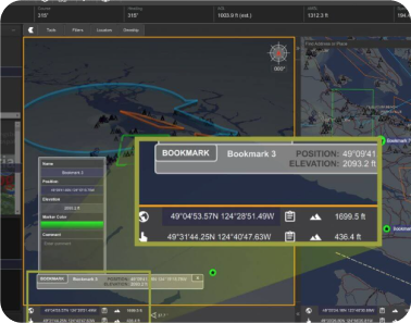
The TerraLens real-time geospatial SDK is designed to help developers achieve high-performance 2D and 3D mapping without the frustration.
Built on a highly optimized architecture, TerraLens supports virtually any development environment and map data format. TerraLens is the tool serious developers use to equip military decision-makers with real-time situational awareness for command and control applications.
TerraLens leads the industry in real-time performance, overall capabilities, documentation, and customer support for C2 applications.
TRY TERRALENS NOW


While optimized for low-power hardware, TerraLens allows your mapping software to leverage the GPU and CPU for accelerated terrain in 3D for state-of-the-art visualization.
TerraLens also includes a flexible and full-featured UI development toolset that includes advanced multi-touch support.
TRY TERRALENS NOW
simultaneous tracks
consistently at 4K resolution
simultaneous tracks
2D & 3D viewports


TerraLens supports most
major platforms, operating systems, IDEs, and
compilers
Ingest virtually any map
data format - many without preprocessing.
TerraLens is fully customizable
and compatible with most GUI toolkits, including Qt, Qt Quick, QML, and Java.
Standards-based and
platform-independent, the TerraLens SDK is extensible
to any use case.

In addition to our leading-edge technology and performance, thousands of TerraLens deployments rely on world-class support from Kongsberg Geospatial. Unlike open-source solutions with limited community-based assistance, we provide responsive, enterprise-grade support that aligns with your project’s timeline and requirements.
With over 30 years of experience powering command and control visualization, situational awareness, and HMI software, our team has the expertise to identify your challenge, determine the right solution, and implement it effectively.


Are you a developer building geospatial mapping software? If so, contact us for a free developer license with dedicated technical support to see if TerraLens is right for your project.