Kongsberg Geospatial will be exhibiting at XPONENTIAL taking place May 11–14 in Detroit, Michigan.
Visit us at Booth 34013!
Book a Meeting

Ottawa, CA: Kongsberg Geospatial announced today the general release of TerraLens 9.3, the latest version of their real-time, high performance, software development toolkit for geospatial visualization.
In this release of TerraLens, the product development team has focused on improving performance for 3D visualization for large viewports, and on multi-domain visualization features for Joint All-Domain command and control applications. Leveraging the power of modern GPUs and multi-core processors, the latest release of TerraLens is significantly faster, with new presentations focused on enhancing situational awareness.
Continue reading
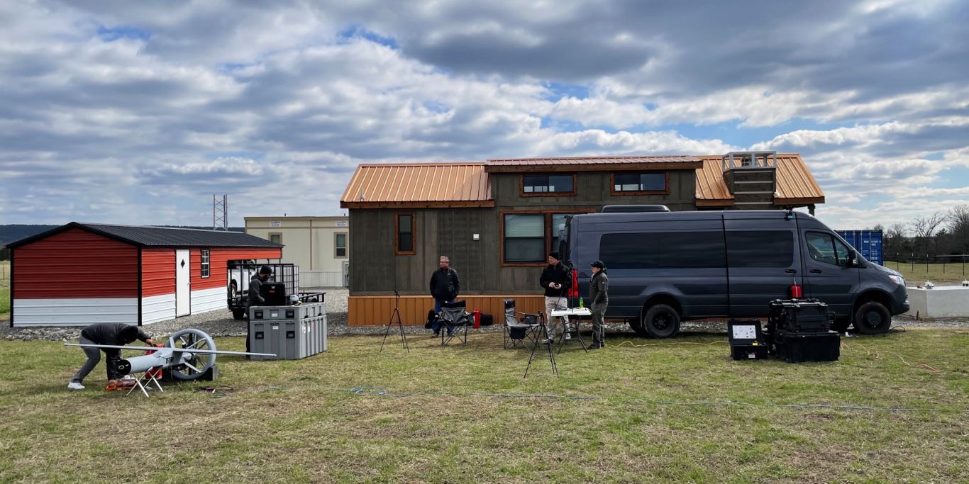
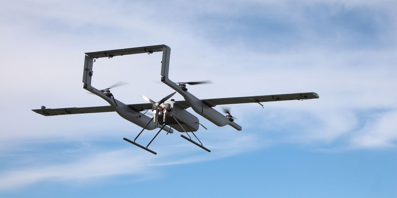
Ottawa, CA: The Canadian Coast Guard was in Oklahoma recently, albeit virtually. Kongsberg Geospatial announced today they successfully conducted Phase 1 trials of the Martin UAV V-BAT on behalf of the Canadian Coast Guard at a UAS test facility operated by the Chocktaw Indian Nation of Oklahoma, in rural southeastern Oklahoma.
Continue reading
Ottawa, CA: Kongsberg Geospatial, developers of the TerraLens Geospatial Software Development Kit (SDK), and Pegasus Imagery Ltd. an aerospace company developing advanced autonomous aircraft and sensor systems, announced today that they have signed an MOU to work together to advance the development of safe, autonomous Unmanned Aircraft.
Pegasus Imagery’s technology includes the Autonomous Airspace Awareness System (A3S) – a Detect and Avoid sensor system that uses airborne radar and other sensors to autonomously avoid potential hazards like birds, other drones and manned aircraft; a Moisture & Icing Detection Alert System (MIDAS) that provides early detection and pilot notification of icing conditions and buildup for manned aircraft; and their own autonomous aircraft, the PV-02 Eos.
Continue reading

Ottawa, CA: Kongsberg Geospatial, developer of the TerraLens Geospatial SDK, and Skyports, a leading enabler of advanced air mobility (AAM), announced today that the Kongsberg Geospatial IRIS airspace situational awareness application has been adopted by Skyports. The technology will be used by Skyports’ logistics arm, Delivery by Skyports, to enhance their BVLOS operations.
Continue reading
Kongsberg Geospatial is a fully owned subsidiary of Kongsberg Defence & Aerospace
Back To Top
.svg)


.png)