Products
Products
TerraLens
Real-Time Geospatial SDK
TerraLens Server
Multiformat Map Tile Server
TerraLens Creator
Map Deployment Toolkit
IRIS GCS
BVLOS Ground Control Station
IRIS Terminal
Enterprise Airspace Visualization
MDCS
Multi-Domain Control Station
I-SIM
Air Traffic Controller Training
Innovative
Technologies
TerraLens 3D Web
3D Javascript Library
TerraLens Mobile
Mobile GIS for Android
MIDAS
UAS Sensor Data Exploitation
THEIA
Airport Surface Awareness
Services
Services
HMI / UX Development
Development Acceleration
Industries
Industries
Defense
Unmanned Systems
Company
Company
About
Careers
Contact
Resources
Resources
News
Blog
Videos
Contact Us
Blogs
Working Out the Kinks – Handling Error Messages and Diagnostic Information
Written on
August 4, 2021
Continue reading
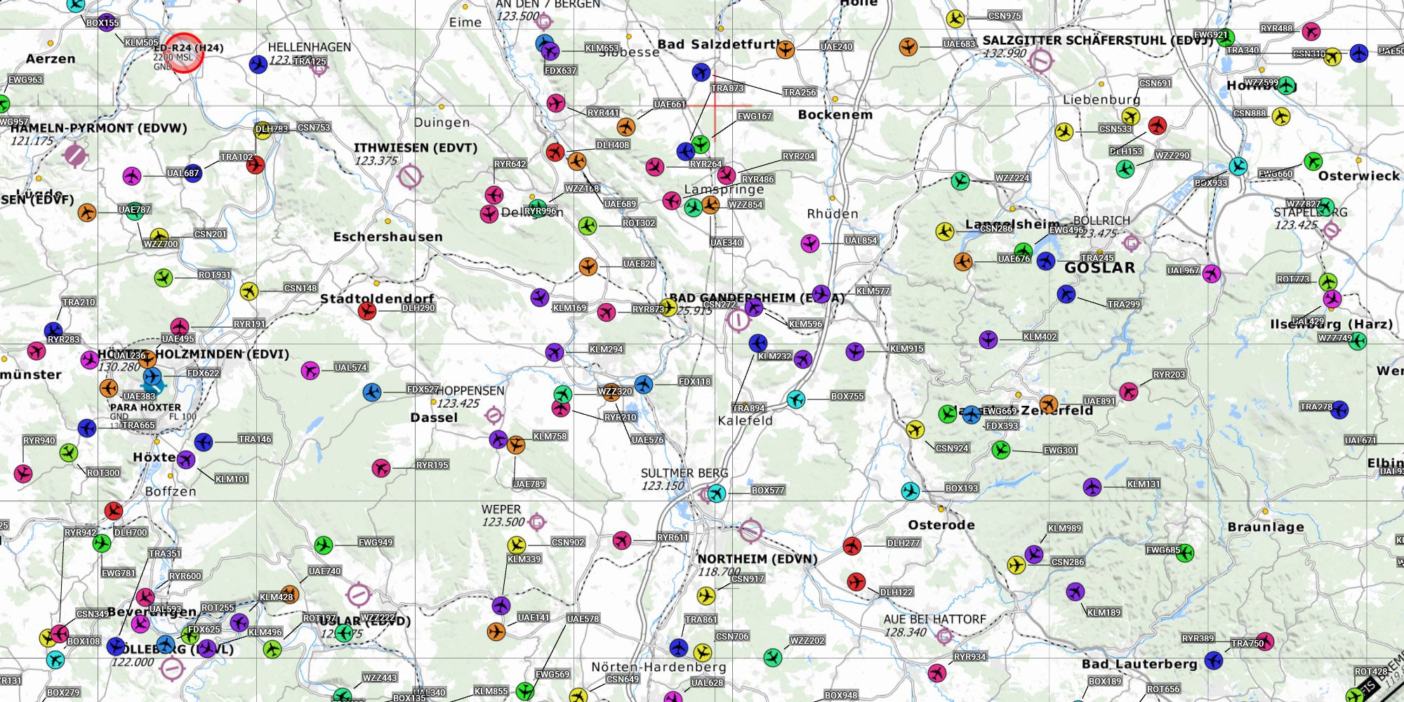
De-Cluttering Labels on Complex Maps
Written on
July 15, 2021
Continue reading
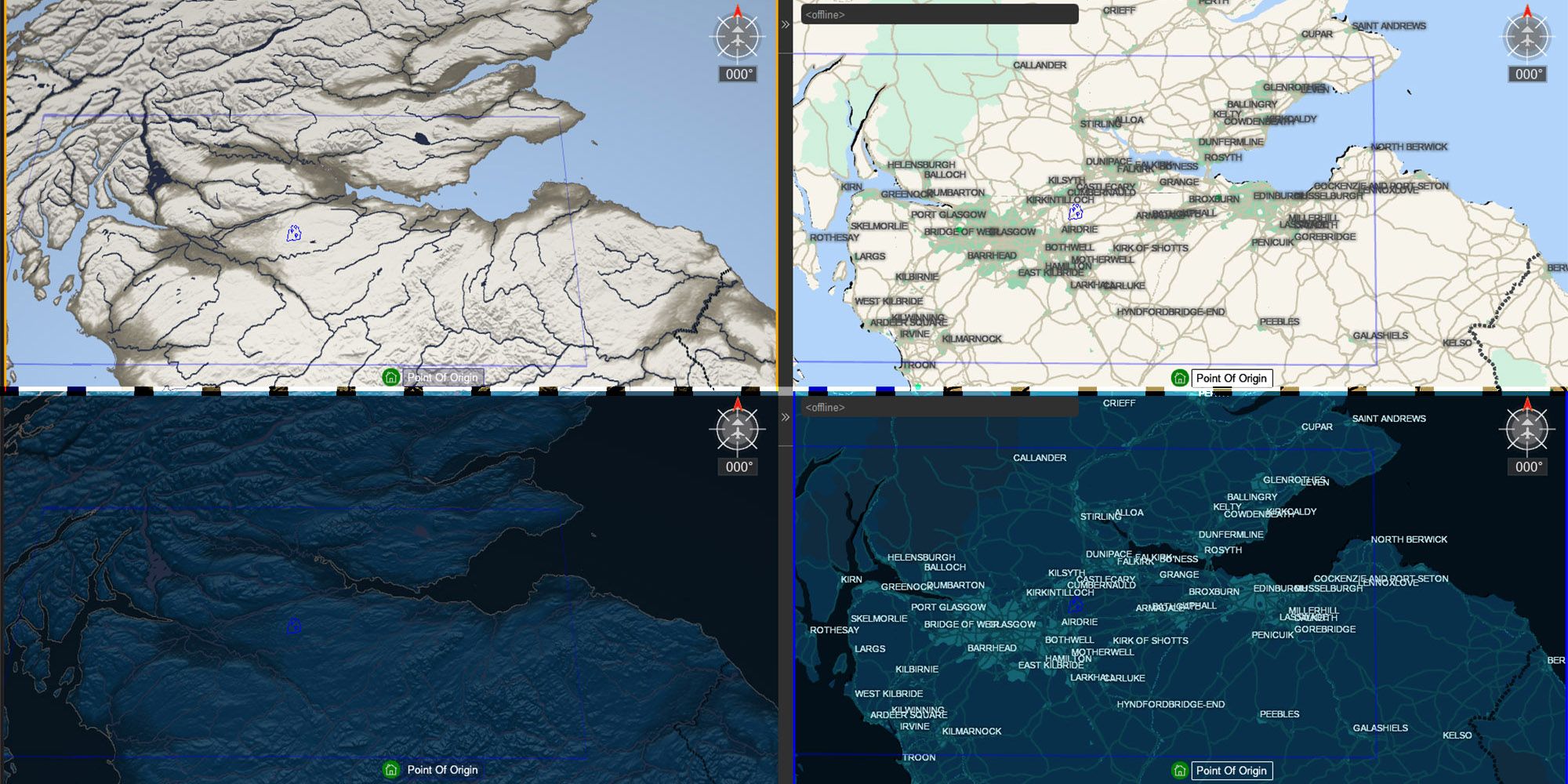
Provisioning, Styling and Deploying Maps for IRIS GCS
Written on
June 14, 2021
Continue reading
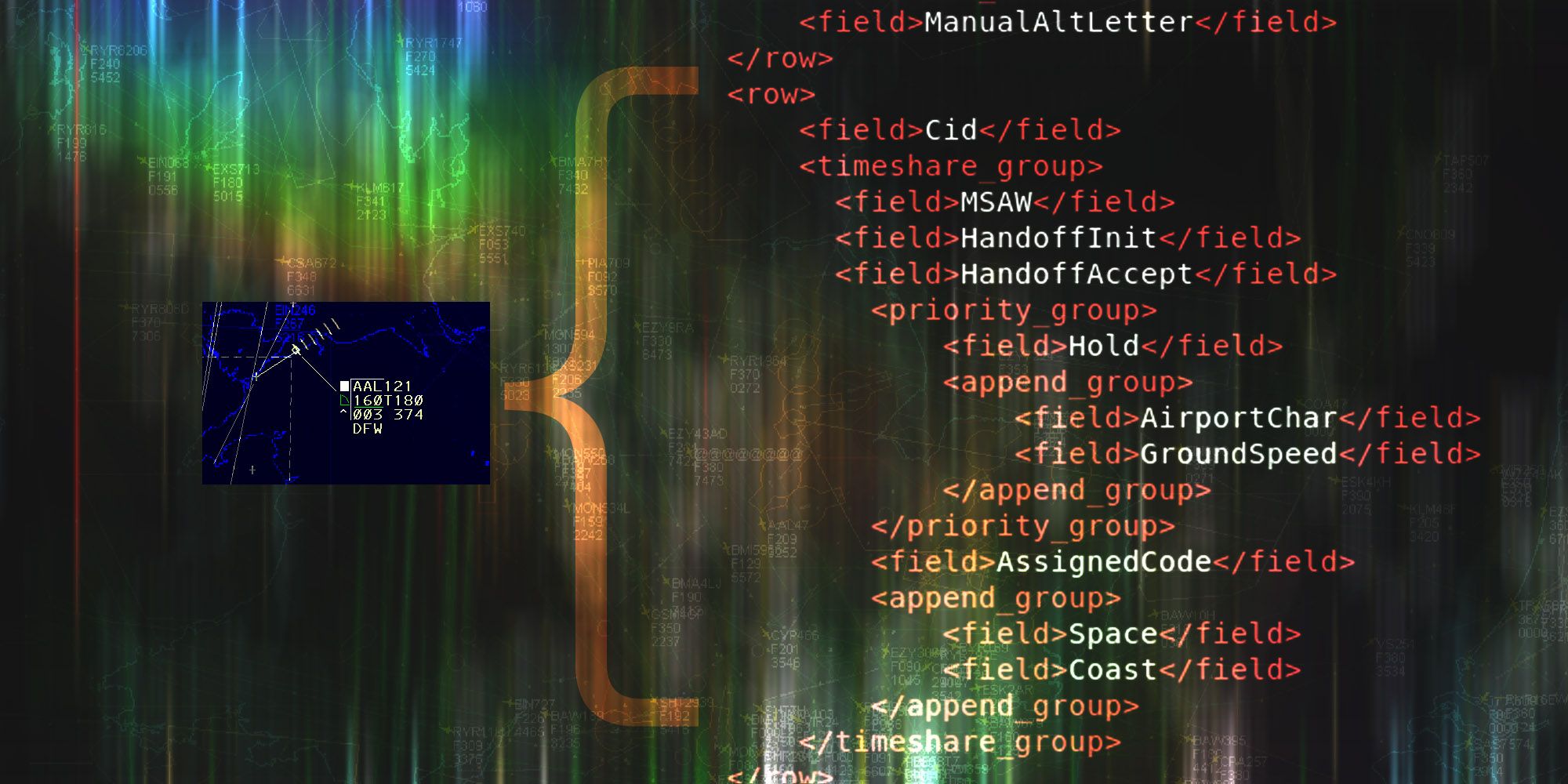
Configurable Complex Track Data Tag Formats in STARS/ERAM Applications
Written on
May 21, 2021
Continue reading
Fundamental Sensor Fusion
Written on
May 14, 2021
Continue reading
Previous
Next
More Articles
TerraLens 9.4: Elevate Military Decision Superiority with Cutting-Edge Geospatial Software
Phoenix Air Unmanned authorised to operate BVLOS with assistance of IRIS Terminal
How Kongsberg Geospatial’s IRIS Terminal answers some of the DAA questions in the recently updated FAA Part 107 WSEG
The Importance Of Cognitive Load Management For Complex UAS Operations

.svg)